Map the Block › Data › Crime
Mass Shootings Map: Every U.S. Mass Shooting Since 1900
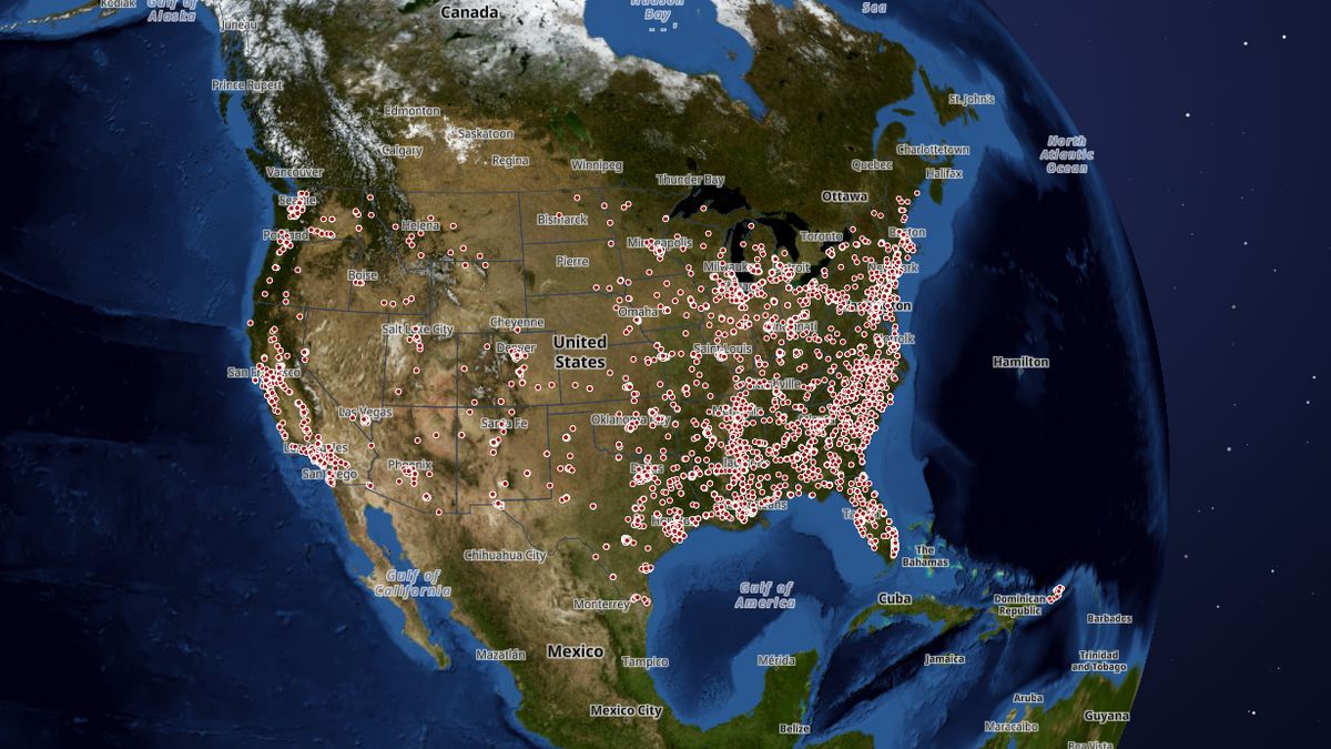
Where and when mass shootings have happened in the United States, and how many people were killed and hurt.
Since 2014, when records became most complete, the map counts 6,529 — the most in 2022 (749). In all, 6,927 are mapped, in which 8,927 people were killed and 29,221 injured.
 Open the live map →
🕯️Shootings per year since 2014
📍Deadliest
| Where | Date | Killed | Injured |
|---|---|---|---|
| Las Vegas, NV | 2017-10-01 | 60 | 439 |
| Orlando, FL | 2016-06-12 | 49 | 53 |
| Greenwood, Tulsa, OK | 1921-05-31 | 36 | 800 |
| Ocoee, FL | 1920-11-02 | 32 | 0 |
| Blacksburg, VA | 2007-04-16 | 32 | 17 |
| Newtown, CT | 2012-12-14 | 27 | 2 |
| Sutherland Springs, TX | 2017-11-05 | 26 | 20 |
| Herrin, IL | 1922-06-21 | 23 | 0 |
| San Diego, CA | 1984-07-18 | 23 | 19 |
| Killeen, TX | 1991-10-16 | 23 | 20 |
🔎About this data
Each dot is one shooting where 4 or more people were shot (not counting the shooter), or 4 or more killed. Trackers define mass shootings differently, so 'Counts as' shows which definitions it meets. Shootings at homes, and Gun Violence Archive locations, are placed at about 1 km, never an exact address. No names are shown. Older years are incomplete: they come from historical lists, and 2013 is thin.
Source: Gun Violence Archive (2014 onward), Wikipedia lists of U.S. mass shootings (CC BY-SA), Stanford Mass Shootings in America 1966-2016 (CC BY 4.0)
Coverage: Nationwide, 1900 to October 2026 (2014 onward is most complete)
How it was checked: Deaths agree with a second independent source for 25 of 27 hand-checked events (93%); 2014-2025 counts follow the Gun Violence Archive.
💬Questions and answers
How many mass shootings happen each year?
Since 2014, when records became most complete, the map counts 6,529 — the most in 2022 (749). In all, 6,927 are mapped, in which 8,927 people were killed and 29,221 injured.
Where does this data come from?
Gun Violence Archive (2014 onward), Wikipedia lists of U.S. mass shootings (CC BY-SA), Stanford Mass Shootings in America 1966-2016 (CC BY 4.0). Coverage: Nationwide, 1900 to October 2026 (2014 onward is most complete).
Is the map free to use?
Yes. Map the Block is free, with no ads or paywall. You may quote figures with credit to Map the Block (maptheblock.com); for bulk or commercial use there is a Data API.
🧭More maps like this
Keep the map free. Map the Block has no ads and no paywall. Donations pay for the server and the data work.
Numbers computed from the live map data on October 18, 2026. Free to quote with credit to “Map the Block (maptheblock.com)”; see reuse terms.