Map the Block › Data › Crime
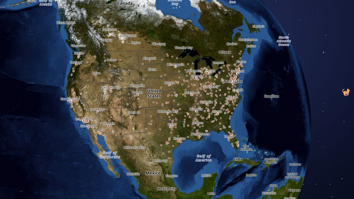
School Shootings Map: U.S. School Shootings Since 1840
Every recorded shooting at a U.S. school or college, by state and year.
Since 2014, when records became most complete, the map counts 536 — the most in 2025 (70). In all, 1,283 are mapped, in which 911 people were killed and 1,824 injured.
 Open the live map →
🏫Shootings per year since 2014
🕯️Deadliest
| Where | Date | Killed | Injured |
|---|---|---|---|
| Bath School | 1927-05-18 | 45 | 58 |
| Virginia Tech | 2007-04-16 | 32 | 23 |
| Sandy Hook Elementary School | 2012-12-14 | 26 | 2 |
| Robb Elementary School | 2022-05-24 | 21 | 12 |
| University of Texas | 1966-08-01 | 18 | 31 |
| Marjory Stoneman Douglas High School | 2018-02-14 | 17 | 17 |
| Columbine High School | 1999-04-20 | 13 | 21 |
| Umpqua Community College | 2015-10-01 | 10 | 9 |
| Santa Fe High School | 2018-05-18 | 10 | 13 |
| California State University, Fullerton | 1976-07-12 | 7 | 2 |
🔎About this data
Every reported shooting at a school or college we could confirm, including gunfire with no one hit and accidental shots, so parents can see the whole picture; 'What happened' tells them apart. Trackers count school shootings very differently, so totals vary between sources. The 1960s look busy because historians researched that decade closely. No names of students, victims or shooters are shown.
Source: Wikipedia lists of school shootings in the United States (CC BY-SA); Washington Post school shootings database (shared incidents only); school locations from NCES (U.S. Department of Education)
Coverage: Nationwide, K-12 schools and colleges, 1840 to September 2026
How it was checked: Of 214 incidents in both Wikipedia and the Washington Post database, 97% share the date and 91% the death count.
💬Questions and answers
How many school shootings happen each year?
Since 2014, when records became most complete, the map counts 536 — the most in 2025 (70). In all, 1,283 are mapped, in which 911 people were killed and 1,824 injured.
Where does this data come from?
Wikipedia lists of school shootings in the United States (CC BY-SA); Washington Post school shootings database (shared incidents only); school locations from NCES (U.S. Department of Education). Coverage: Nationwide, K-12 schools and colleges, 1840 to September 2026.
Is the map free to use?
Yes. Map the Block is free, with no ads or paywall. You may quote figures with credit to Map the Block (maptheblock.com); for bulk or commercial use there is a Data API.
🧭More maps like this
Keep the map free. Map the Block has no ads and no paywall. Donations pay for the server and the data work.
Numbers computed from the live map data on October 18, 2026. Free to quote with credit to “Map the Block (maptheblock.com)”; see reuse terms.