Map the Block › Data › Environment & hazards
Superfund Sites Map: Every EPA Cleanup Site
Where the EPA's most contaminated sites are and which are still being cleaned up.
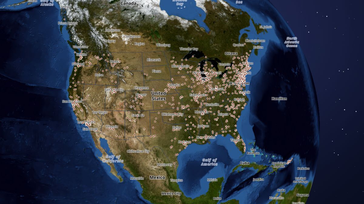
The map shows 1,822 Superfund sites. New Jersey has the most (153), then Pennsylvania (126) and New York (122).
 Open the live map →
☣️Sites by status
🧪States with the most Superfund sites
🔎About this data
Sites on EPA's National Priorities List (final) or proposed for it, where EPA is managing a long-term cleanup. Being listed means EPA is handling the cleanup; it doesn't by itself mean people are exposed today. Each dot is the centre of EPA's mapped site boundary.
Source: U.S. EPA, Superfund site boundaries and NPL status (October 2026)
Coverage: Nationwide (incl. Puerto Rico and territories)
How it was checked: 1,321 final sites mapped = 98% of the 1,343 EPA lists on its NPL summary page (August 2026); 36 proposed vs EPA's 37. 99.5% of dots fall inside the state EPA lists for the site.
⬇️Download this data
The first 25 rows of the full file, with all 11 columns, so you can see exactly what you get.
Sample CSVA free key gives you 1,000 calls a month: look up any county, state or address and get every figure on this page.
Get a free keyAll 1,822 rows as CSV or GeoJSON, refreshed when the map updates. Included with the Data API from $19 a month (commercial use from $79).
See plansDataset superfund · full file at /api/v1/bulk/superfund.csv with your key · see the data terms.
💬Questions and answers
How many Superfund sites are there in the United States?
The map shows 1,822 Superfund sites. New Jersey has the most (153), then Pennsylvania (126) and New York (122).
Where does this data come from?
U.S. EPA, Superfund site boundaries and NPL status (October 2026). Coverage: Nationwide (incl. Puerto Rico and territories).
Is the map free to use?
Yes. Map the Block is free, with no ads or paywall. You may quote figures with credit to Map the Block (maptheblock.com); for bulk or commercial use there is a Data API.
🧭More maps like this
Keep the map free. Map the Block has no ads and no paywall. Donations pay for the server and the data work.
Numbers computed from the live map data on October 18, 2026. Free to quote with credit to “Map the Block (maptheblock.com)”; see reuse terms.