Map the Block › Data › Transportation
Road Construction Map: Highway Work Zones Today
Current highway construction and work zones, updated every morning from state transportation departments.
The map shows 11,529 highway work zones. Wisconsin has the most (2,518), then Arizona (749) and Iowa (745).
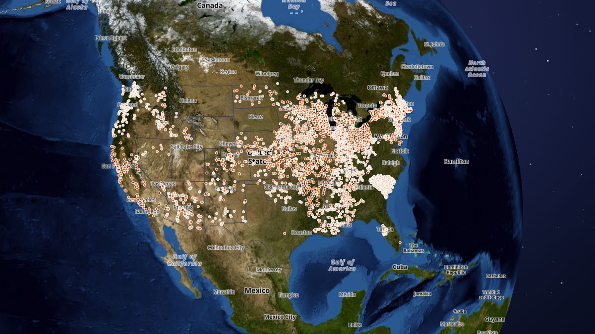 Open the live map →
🚧Work zones by road type
🛣️States with the most highway work zones
🔎About this data
Current highway construction and work zones (active now or starting within 14 days), one dot per work zone at the middle of its stretch of road. Many states, including California, New York, Texas (state highways), Ohio and Pennsylvania, don't publish an open feed yet, so they are missing. Plans change daily: check your state's 511 before you drive.
Source: State departments of transportation, via the U.S. DOT Work Zone Data Exchange (WZDx) and state 511 feeds; refreshed every morning
Coverage: 41 states from their own traffic and 511 feeds: AL, AR, AZ, CA, CO, CT, DE, FL, HI, IA, ID, IL, IN, KS, KY, LA, MA, MD, MI, MN, MO, MS, NC, ND, NE, NH, NJ, NM, NV, NY, OH, OK, OR, SC, TN, TX, VA, VT, WA, WI, WV. Interstates, U.S. highways and state highways only. South Carolina and New Hampshire list ongoing construction projects rather than daily lane closures.
How it was checked: Matched event by event against the states' own 511 maps: Kansas 140 of 142, Indiana 356 of 358, Maryland 48 of 48, New York 578 of 578, Colorado 50 of 52 (the other 2 are merged two-direction zones). Truck size limits and some full closures that states don't publish as work zones are not included.
💬Questions and answers
How many highway work zones are there in the United States?
The map shows 11,529 highway work zones. Wisconsin has the most (2,518), then Arizona (749) and Iowa (745).
Why are some states missing?
Only states that publish an open work-zone feed can be mapped. Today there is no data for 13 of the 50 states and DC, including Alaska, District of Columbia, Georgia, Hawaii, Maine, Montana, North Carolina, Pennsylvania and others. Check that state's 511 service instead.
Where does this data come from?
State departments of transportation, via the U.S. DOT Work Zone Data Exchange (WZDx) and state 511 feeds; refreshed every morning. Coverage: 41 states from their own traffic and 511 feeds: AL, AR, AZ, CA, CO, CT, DE, FL, HI, IA, ID, IL, IN, KS, KY, LA, MA, MD, MI, MN, MO, MS, NC, ND, NE, NH, NJ, NM, NV, NY, OH, OK, OR, SC, TN, TX, VA, VT, WA, WI, WV. Interstates, U.S. highways and state highways only. South Carolina and New Hampshire list ongoing construction projects rather than daily lane closures..
Is the map free to use?
Yes. Map the Block is free, with no ads or paywall. You may quote figures with credit to Map the Block (maptheblock.com); for bulk or commercial use there is a Data API.
🧭More maps like this
Keep the map free. Map the Block has no ads and no paywall. Donations pay for the server and the data work.
Numbers computed from the live map data on October 23, 2026. Free to quote with credit to “Map the Block (maptheblock.com)”; see reuse terms.