Map the Block › Data › Education
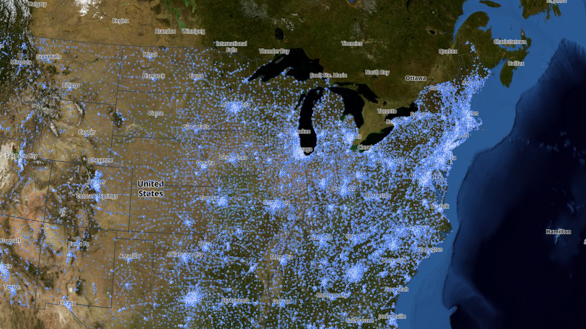
Public Schools Map: Every Public School in the U.S.
Every public school, its district, enrolment and spending per student.
The map shows 102,066 public schools. California has the most (10,407), then Texas (9,774) and New York (4,865).
 Open the live map →
🏫States with the most public schools
🔎About this data
Every public school in the 2024-25 federal school list (about 102,000), with its school district's budget. Budgets are published per district, not per school, so each school shows its district's totals and its average spending per student. U.S. public schools spent $842 billion on day-to-day costs in 2024 (Census). About 1 in 10 schools (mostly charter and state-run schools that are not part of a district in the Census survey) show no budget. Dense areas are thinned when zoomed out; zoom in to see every school.
Source: National Center for Education Statistics, EDGE public school locations 2024-25; budgets: U.S. Census Bureau, Annual Survey of School System Finances, fiscal year 2024
Coverage: Nationwide
How it was checked: 84–89% of schools in Texas, Ohio and Colorado have a matching school in OpenStreetMap. Budgets: district figures add up to 98.8% of the Census Bureau's published U.S. total for day-to-day school spending ($832 billion of $842 billion; the rest is state-run schools); New York City works out to $40,912 per student.
💬Questions and answers
How many public schools are there in the United States?
The map shows 102,066 public schools. California has the most (10,407), then Texas (9,774) and New York (4,865).
Where does this data come from?
National Center for Education Statistics, EDGE public school locations 2024-25; budgets: U.S. Census Bureau, Annual Survey of School System Finances, fiscal year 2024. Coverage: Nationwide.
Is the map free to use?
Yes. Map the Block is free, with no ads or paywall. You may quote figures with credit to Map the Block (maptheblock.com); for bulk or commercial use there is a Data API.
🧭More maps like this
Keep the map free. Map the Block has no ads and no paywall. Donations pay for the server and the data work.
Numbers computed from the live map data on October 18, 2026. Free to quote with credit to “Map the Block (maptheblock.com)”; see reuse terms.